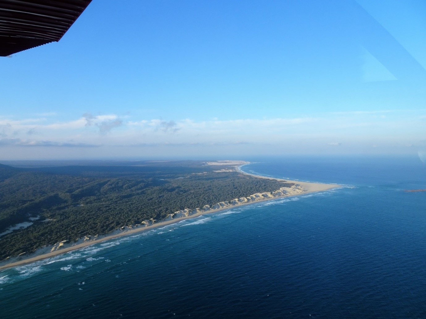
Cape Howe and Gabo Island
Grade 4: Cape Howe, the south east corner of the Australian continent has the distinction today of being the most remote land feature named by Cook on the coasts of Victoria and New South Wales. Reaching it by land requires an overnight walk. It remains untouched by the modern world and just as it was when Cook saw it. It is possible to stay in the lighthouse buildings on Gabo Island (recommended!), see https://www.parks.vic.gov.au/places-to-see/parks/gabo-island-lighthouse-reserve
Situation: Remote. Cape Howe is situated 20km east of Mallacoota, Victoria, and 30km south of Wonboyn, NSW. Only hardy walkers with a permit visit it. For access see Parks Victoria, Croajingolong National Park.
Coordinates (decimal):
Cape Howe: 37.51 S 149.98 E
Gabo Island: 37.56 S 149.91 E
Endeavour Journal, 20 April 1770:
At 6 oClock [p.m.] shortened sail and brought to for the night having 56 fathoms of water a fine sandy bottom, the Northermost land in sight bore NBE ½ E and a small Island [Gabo Island] lying close to a point on the Main bore west distant two leagues. This point I have named Cape Howe, it may be known by the Trending of the Coast which is north on the one side and SW on the other (Latitude 37 28 S, Long 210.3 West [149.57 E]) it may likewise be known by some round hills upon the Main just within it.
Twelve hours after his first supposed sighting of the Australian continent Cook would have been excited by what he saw. The coast that had run south west to north east now trends north. Within a few hours of his first landfall he appears to have found the east coast of New Holland. Cook names this important cape after an important man, Richard Howe, Earl Howe (1726-99) who was one of the Lords of the Admiralty when Cook left England. The Lords were the decision makers for the Royal Navy and had chosen Cook to lead this voyage. Cook mentions, but does not name, Gabo Island.
In 1971 Brigadier Lawrence FitzGerald, in an article in Victorian Historical Magazine, claimed that Telegraph Point, just to the north of Gabo Island, Victoria, was the feature that, in April 1770, Lt James Cook named as Cape Howe. A number of reputable sources have since accepted FitzGerald’s claim as correct.
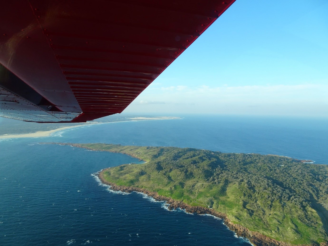
FitzGerald’s key premise is that Telegraph Point is the nearest point on the mainland, so it must be the point Cook was referring to as ‘lying close’ to his Cape Howe. But Cook doesn’t say that Cape Howe was the nearest point to the island, only that the island was ‘lying close’ to it. Gabo Island is not Cook’s defining parameter for his Cape; it is the ‘Trending of the Coast’.
Cook’s purpose in naming land features was to assist later navigators on the coast to determine their position. Accordingly, Cook’s named features are distinctive and usually easily recognised from well out to sea, being distinctive mountains or cliffs. In this case Cape Howe (and Telegraph Point) are both low lying sand spits and would not be visible unless navigators were quite close to the coast. But the Cape would, as Cook states, ‘be known by the Trending of the Coast’.
Cook gives further guidance to later navigators: ‘it may likewise be known by some round hills upon the Main just within it’. The hills were worthy of mention since they would be more visible to navigators than the sand spits. The ‘round hills’ are sand hills, several of which are shown by 30 or 40m contours on topographical maps of the area behind today’s Cape Howe. Had Cook been describing the hills behind Telegraph Point he would have noted Howe Hill, a distinctive 391m high feature just 4km north north west of this Point.
Cook’s 6 p.m. position provides him with his first clear view to the north. There is open sea to the east and he gives a bearing for the ‘northermost land’ he could see, which would have been Green Cape. This is a defining moment for Cook, as he suspects that he is about to head north along the uncharted east coast of the continent. Cape Howe is likely to be not just another cape but the continent’s south east corner, and clearly qualifies as a distinctive feature useful to navigators. Telegraph Point does not.
References:
For more detailed information and sources see:
Trevor Lipscombe, Contested Borders – is Cook’s Cape Howe really Telegraph Point? Placenames Australia, March 2018. https://www.anps.org.au/upload/March_2018.pdf
Trevor Lipscombe, Lt James Cook on the coast of
Victoria 1770, Victorian Historical
Journal, vol.89, no.1, June 2018.